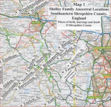
The villages that the Shelley family ancestors came from are located primarily in southeast Shropshire County. Shropshire is in west midland England. It is also known as Salop. It is a large county with a small population mostly in villages. The River Severn divides Shropshire equally into northeast and southwest halves. The meadows alongside the Severn are very fertile. The River separates the rolling acres of fertile agriculture lands in the north and east from the less fertile majestic hills of the south and west. The countryside has farms, herds of sheep, grazing cattle, cottages, grain fields and many trees (Pigots Directory of Shropshire, The Shropshire Village Book).
The villages that the Shelley family ancestors came from in Shropshire County are shown on the map below. Click on a village to go to it.
Abdon. Click here for Abdon.
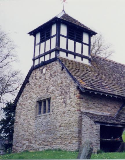
Alice Collier (4th-great-grandmother, 1732), an ancestor of Elizabeth Bray, was christened in the Badger Church. Her father, John Collier (5th-great-grandfather), was the Rector (Clergyman) at Badger (from 1729 to 1737) when she was born.
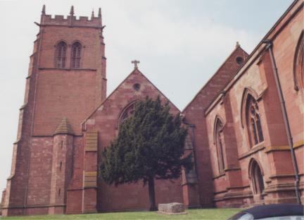
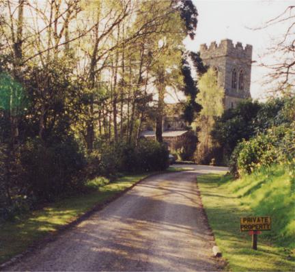
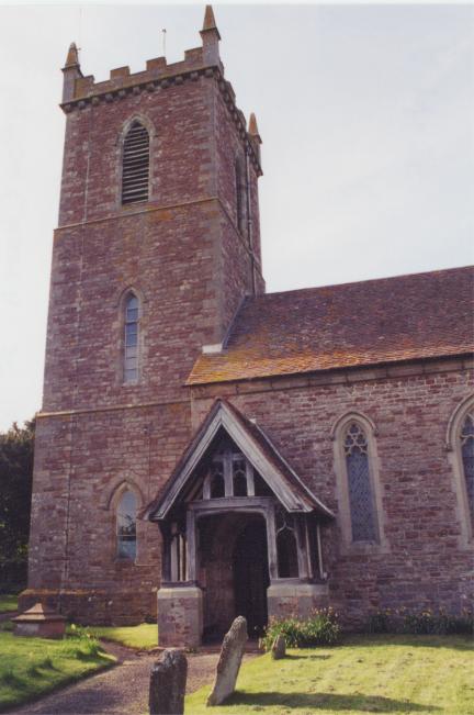
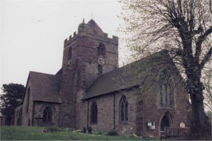
Badger is a small parish and village. St. Giles Church is a Gothic stone building rebuilt in 1834. A new nave was built into the old tower of the St. Giles Church in 1834. The church looks very different today than it did before 1834 and plans or pictures of the old church do not exist (Chantrey, Directories of Shropshire & Herefordshire. Page 276, Pigots Directory of Shropshire. Page 93).
Martha Shelley (3rd-great-grandmother, 1770) died here in 1802 when James Bowyer Shelley (2nd-great-grandfather, 1792) was just ten. It is possible that James lived here when he was a young child. Since Bridgnorth is a market town, Martha�s husband and James� stepfather, Samuel Hughes, probably worked in town rather than in agriculture.
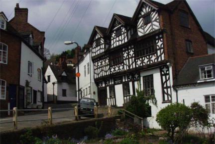
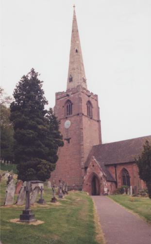
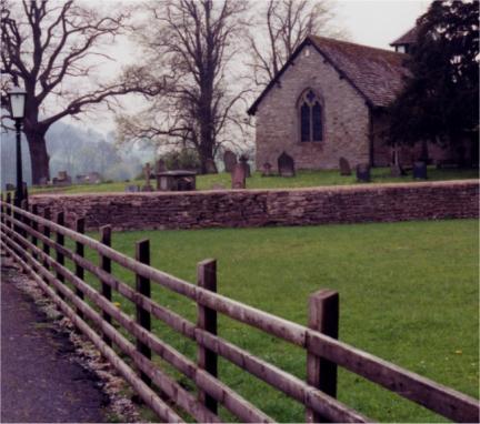
Bridgnorth is a market town with a view located on the Severn River. Bridgnorth has a history dating back to 912 AD when the Saxons built a fort on the Castle Hill site. Bridgnorth is referred to as �The Jewel of The Severn.� A Norman Castle was built at the site of the Saxon fort in 1101. In 1642 King Charles, while at Bridgnorth Castle for three days said, �the view from the Castle Walk is the finest view in my dominion.� Four years later when the parliamentary forces captured the Castle during a Civil War it was destroyed by gunpowder. Today, only a small portion of the castle wall still exists.
Upper Town is on the summit of a hill on the west bank of the Severn. On the east bank is Lower Town. An attractive stone bridge connects them.St. Leonard�s Church was remodeled between 1835 to 1870 but dates from the 17th century. The font is from 1894. The organ is from 1865. Richard Baxter, a Puritan Divine, began his ministry at St. Leonard�s Church in 1640
St. Mary Magdalene Church was built in 1792 and enlarged in 1876. The cemetery is located east of Low Town. (Directories of Shropshire & Herefordshire, Page 284, St. Leonard�s Church Bridgnorth, and Pigots Directory of Shropshire, Page 3).
Sarah Tasker (4th-great-grandmother, 1725) and Thomas Tasker (4th-great-grandfather, 1727) were christened here. The church they were christened at no longer exists. They were the grandparents of Elizabeth Bray (2nd-great-grandmother, 1795).
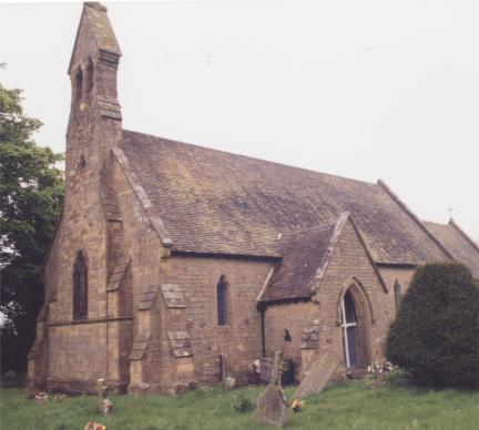
Burwarton is a small village on the eastern slope of Brown Clee Hill. St. Lawrence Church was built in 1876 and replaced a small Norman church that was built on a contiguous site. (Directories of Shropshire & Herefordshire, Page 292, The Shropshire Village Book, Page 32).
James Bowyer Shelley (2nd-great-grandfather, 1792) may have been born or christened (1794) here. Most biographical sketches indicate he was born here. He may have been born or christened at Claverley. We haven�t found a christening record in Claverley or Chetton Parish (Genealogical Department. Claverley, Genealogical Department. Chetton). From 1549, when Richard Overton (9th-great-grandfather) was christened here to 1648 when William Morris (6th-great-grandfather) was christened here and 1653 when Anne Overton (7th-great-grandmother) was buried here, it was the home of ancestors of James Bowyer Shelley.
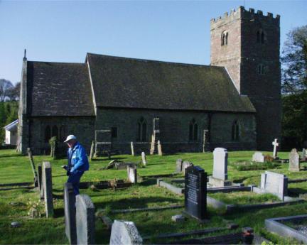
Chetton is a village on a spur of Brown Clee Hill. The village has Tudor cottages. It had its own coal seam where residents obtained their coal from a shallow pit. Chetton also had a brick works. The St. Giles Church is built in the Early English style. It was originally built about 1086 but has been rebuilt several times (Directories of Shropshire & Herefordshire, Page 295, The Shropshire Village Book, Page 39).
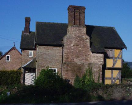
In Chetton, we met Mr. and Mrs. Pugh, a very friendly local farmer and his wife. They lived in a farmhouse that was originally built in the 15th century. An addition was added to the house in 1647.
Claverley. Click here for Claverley.
Francis Bray (5th-great-grandfather, 1698) was buried here in 1729. He was an ancestor of Elizabeth Bray (2nd-great-grandmother, 1795).
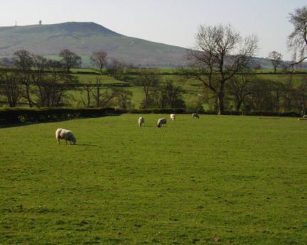
Clee St. Margaret is a village linked to Abdon by a narrow lane with tall hedges. It is on the western slope of Brown Clee Hill. The St. Margaret Church is in the village (The Shropshire Village Book, Page 43).
Martha Shelley (3rd-great-grandmother, 1770) was christened here. Her father, John Shelley (4th-great-grandfather, 1737) was also born here. Martha Shelley probably lived in Easthope as a child. She met James Bowyer, the father of James Bowyer Shelley (2nd-great-grandfather, 1792), here. Mary Annie Jacklin, the mother of Carl Shelley, verbally passed on to us �there was a brickyard near the town where Martha lived (in the 1790s). This is where she met James Bowyer.�
Easthope is a small village with the St. Peter Church. The church is an �old ruble and stone building� repaired in 1852 (Directories of Shropshire & Herefordshire, Page 316).
A farmer in Easthope confirmed that there was a brick works in Easthope. It was on the adjacent farm�s land and is near the Church. The farmer discovered it while plowing his field. Two properties were shown on the Tithe Map for Easthope (Shropshire Records and Research Center) as limekiln, which confirm this. According to The Shropshire Village Book, �Bricks made at Easthope were baked in a kiln in the field above the big trout pool, the clay being dug from the field. Finished bricks were transported by rail down Easthope Cottage Farm fields in front of the then Dower House and across the road. The bricks were used to build a number of the local houses and buildings (59).�
Ann Roberts (4th-great-grandmother, 1738), the grandmother of James Bowyer Shelley, was christened here.
Farlow is a small-scattered community with a church, buildings, and cottages linked by narrow winding lanes. It was part of Herefordshire until 1844. Most residents were farmers. Originally Farlow was a typical cross roads settlement, complete with thatched cottages, a blacksmith�s shop and a corn mill. A green meadow in the village was used for cock fighting. St. Giles Church in the village was erected in 1858 in the Early English style (Directories of Shropshire & Herefordshire, Page 323, The Shropshire Village Book, Page 65).
Farmcote. Click here for Farmcote.
Elizabeth Bray�s (2nd-great-grandmother, 1795) grandfather, Francis Bray (4th-great-grandfather, 1727), married Sarah Tasker (4th-great-grandmother, 1725) at Kinlet in 1752.
Kinlet is a scattered village. The St. John the Baptist Church dates from the 13th century. It hasn�t been altered much from its original appearance. It is separated from the village on a small hill (The Shropshire Village Book, Page 88).
Richard Cureton (5th-great-grandfather, 1696) married Mary Morris (5th-great-grandmother, 1696) in Morville in 1725. They were ancestors of James Bowyer Shelley.
Morville village has been occupied since Saxon times. The Church of St. Gregory is built on an Old Saxon foundation. It is built in the Late Norman style and contains a Norman font.
Morville Hall, next to the church, was built in 1546 but extensively altered in the 1750s. These buildings are part of an English Heritage site today. It is interesting that a Charles Cureton is living at the Acton Arms in the 19th century according to the directory (The Shropshire Village Book, Page 116, Directories of Shropshire & Herefordshire Page, Page 365).
James Bowyer Shelley (2nd-great-grandfather, 1792) and Elizabeth Bray were married in Neenton in 1818. John Shelley (4th-great-grandfather, 1737) and Mary Cureton (4th-great-grandmother, 1732) were buried in Neenton in 1798.
Neenton is a village on the River Rea where many water mills were situated. The All Saints Church is a stone building, rebuilt in 1871 on the old foundation. The Hall Farm in Neenton was built about 1400 (Directories of Shropshire & Herefordshire, Page 367, The Shropshire Village Book, Page 121).
Francis Bray the Surgeon (4th-great-grandfather, 1727) died in Norncott but was buried in Abdon in 1804.
Norncott is a very small hamlet about one mile west of Abdon (Wilson 467). The postman had heard of Norncott but the minister at Stoke St. Milborough had never even heard of the nearby hamlet. It is small. There aren�t any paved roads to Norncott today; there isn�t even a tiny winding country lane. Because there were restrictions on walking in the countryside due to foot and mouth disease, we took pictures of houses in or near the hamlet with a telephoto lens.
Francis Bray (3rd-great-grandfather, 1753), the father of Elizabeth Bray (1795), was christened here.
Stoke St. Milborough is a small remote village situated on the lower slope leading to Weston Hill, a hill of over 1,000 feet commanding magnificent views. The St. Milburga�s Church was built in the 13th century. It has been restored but changed very little since it was first built. A house served in the early 19th century as a retreat for unmarried women and mothers. It was right on the border between the Cold Weston and Stoke St. Milborough parishes. During this particular period of its history, the occupants of this house when visited by a parish owner moved hurriedly from one half to the other in order to claim money from whichever parish the overseer represented (The Shropshire Village Book, Page 50).
The mother of Charlotte Elsmore, Elizabeth Davenport (2nd-great-grandmother, 1810), was christened here. Elizabeth�s father, Thomas Davenport was born here about 1780.
Wellington is a market town that stands at the convergence of two railways. Trade was important for this mining and agricultural town. In medieval times, Wellington was a center for the processing of cloth and leather. William Withering was born in Wellington in 1741 and went on to discover digitalis as a treatment for heart disease; a discovery that still benefits millions of people throughout the world.
The All Saints Church was built in 1790. It was restored in 1866. Christ Church was built in 1837. It appears as though most items within the church are from the 20th century. The �Wrekin� is a hill of 1,320 feet just two miles from town with good views (Pigots Directory of Shropshire, Page 1027, Directories of Shropshire & Herefordshire, Page 425).
John Cureton (9th-great-grandfather) was married here in 1589. Many generations of Curetons lived here. Mary Cureton (4th-great-grandmother, 1732), the wife of John Shelley, was christened here. Mary�s grandmother, Anne Hocom, was buried here in 1721.
Worfield is a picturesque village on the River Worfe, a tributary to the Severn. Milling was an important industry at one time (grain, paper, and cloth). St. Peter�s Church is an old red sandstone building in the Middle Point style. There isn�t a record of when the church was built. Some details are believed to date from the 14th century. Parts of the tower are thought to be 14th century (rebuilt 15th) and the north wall is thought to be from the 13th century. The church was extensively restored in 1862 (A Guide to St. Peter�s Worfield, The Shropshire Village Book, Page 183, James 28, Directories of Shropshire & Herefordshire, Page 447).
Ancestors of James Bowyer Shelley lived here. Richard Cureton (5th-great-grandfather, 1696), his wife, Mary Morris (5th-great-grandmother, 1696), and her father, William Morris (6th-great-grandfather, 1648), were buried here in 1773, 1742, and 1712 respectively.
Wrockwardine is known as the �village under the hill�. The St. Peter Church is �an ancient cruciform building of red sandstone�. Other important buildings are Orleton Hall, Wrockwardine Hall, and the Old Vicarage (The Shropshire Village Book, Page 184, Directories of Shropshire & Herefordshire, Page 449).
Badger. Map
 St. Gile's Church (1834). Alice Collier (4th-great-grandmother) was born here in 1732. Her father, John Collier, was Rector at the time.
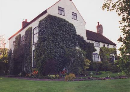
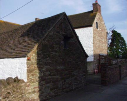
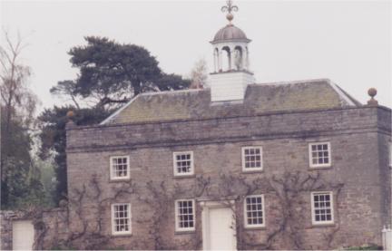
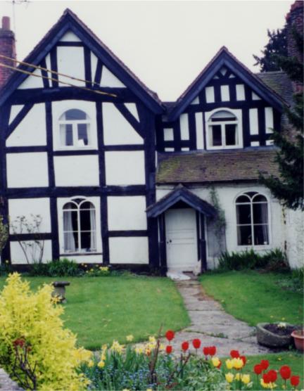
 Badger House.
Bridgnorth. Map
 St. Leonard's Church (Remodeled 1835).
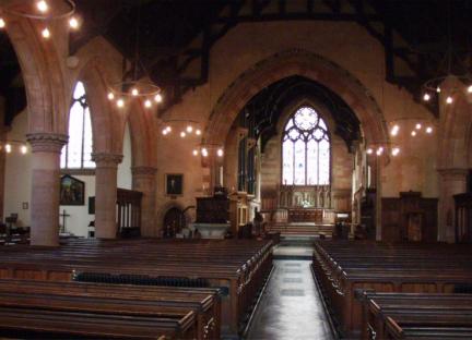 Interior of St. Leonard's Church.
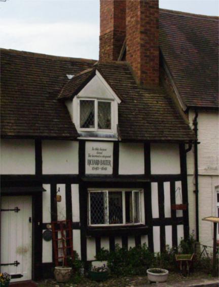 Richard Baxter's house 1640-1641.
 Bishop Percy's house was built in 1580.
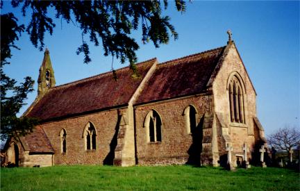
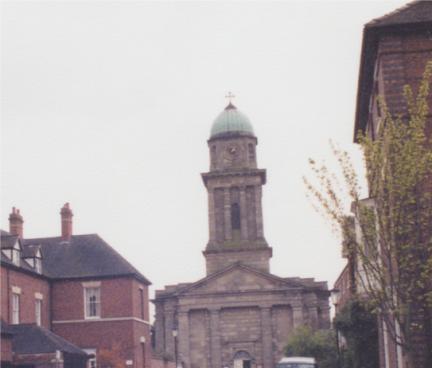 St. Mary Magdalene Church was built in 1792 and enlarged in 1876.
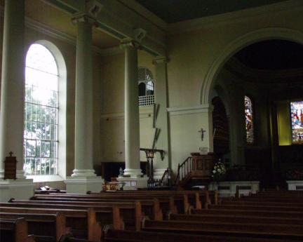 Interior of St. Mary Magdalene Church.
Burwarton. Map
 St. Lawrence Church was built in 1876 and is now a private home.
Chetton. Map
 St. Giles Church was built in 1086 but remodeled.
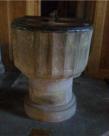
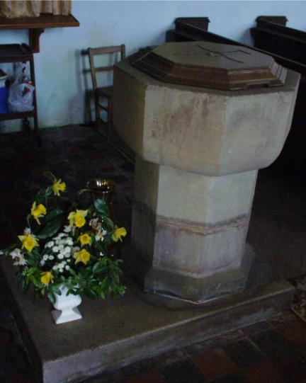 James Bowyer Shelley (2nd-great-grandfather) may have been christened in this font.
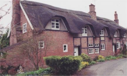
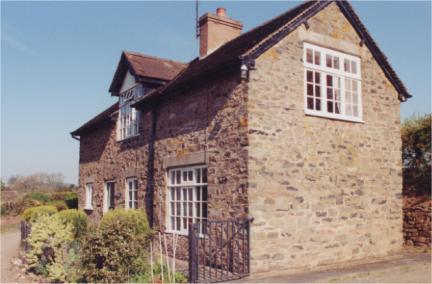
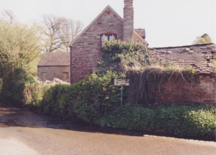
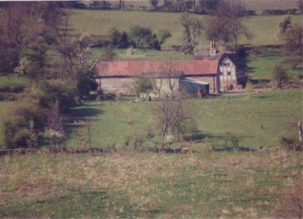
 The Pugh Farmhouse (Built in 15th century).
 Original wall of the Pugh Farmhouse.
Clee St. Margaret. Map
Easthope. Map
 Field where brickyard was located.
Farlow. Map
Kinlet. Map
 The St. John the Baptist Church dates from the 13th century.
 Rape field at Kinlet.
Morville. Map
 Carl Shelley at the entrance to the Church of St. Gregory.
 Morville Hall was built 1546 and later altered in 1750.
Neenton. Map
 All Saints Church where James Bowyer Shelley married Elizabeth Bray (2nd-great-grandparents)on March 30, 1818. It was rebuilt in 1871.
Norncott. Map
 House in or near Norncott.
Stoke St. Milborough. Map
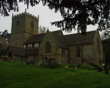
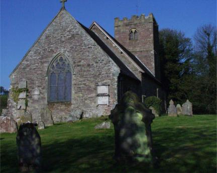 St. Milburga's Church was built in the 13th century and looks similar today.
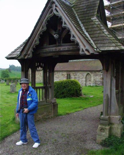
 Carl Shelley in cemetery at St. Milburga's Church.
 Church font. Francis Bray (3rd-great-grandfather) was christened at St. Milburga's Church in 1753.
 House in Stoke St. Milborough.
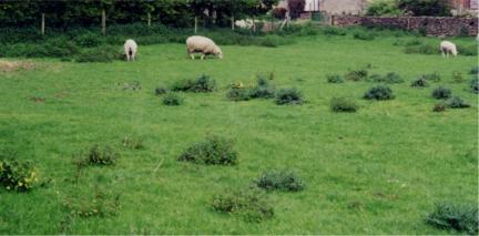
 Field in Stoke St. Milborough.
Wellington. Map
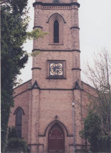
 All Saints Church in Wellington was built in 1790.
 Christ Church in Wellington was built in 1837.
Worfield. Map
 St. Peter's Church was built during 13th, 14th, and 15th centuries.
Wrockwardine. Map
 St. Peter's Church in Wrockwardine.
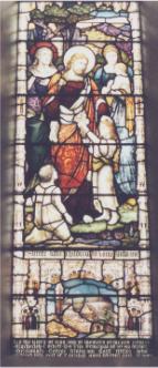
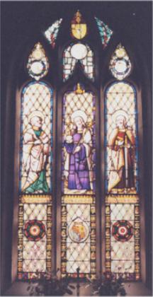 Church Window.
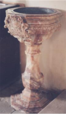 Church Font.
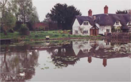 Badger House.
 Font in St. Leonard's Church.
 Interior of St. Giles Church.
 Organ in St. Giles Church.
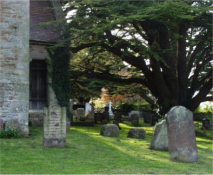 Cemetery at St. Giles Church.
 The Pugh Farmhouse.
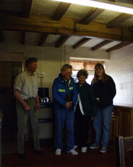 Inside the Pugh Farmhouse (Built in 15th century). Left to Right: Mr. Pugh, Carl Shelley, Edna Shelley, and Alinda Shelley (right).
 House in Clee St. Margaret.
 House in Clee St. Margaret.
 St. Peter Church.
 St. Peter Church.
 House in Easthope.
 House in Farlow.
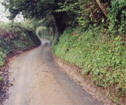 Road to Farlow.
 St. Giles Church.
 Church of St. Gregory.
 House in Neenton.
 House in Neenton.
 House in or near Norncott.
 House in or near Norncott.
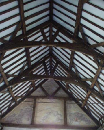 Ceiling in the church.
 Interior of Christ Church.
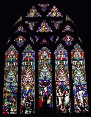
 Window in Christ Church.
 Window in St. Peter's Church.
 Oldest house in Worfield.